Sierra Los Pinos
You are here
Widespread Heavy Rain, Increasing Flash Flood Threat This Week
National Weather Service Albuquerque, NM
www.weather.gov/abq
Significant Event Outlook
“Widespread Heavy Rain, Increasing Flash Flood Threat This Week”
Event:
Type – Widespread heavy thunderstorm rains are expected this week, with an especially active pattern developing during the Tuesday through Thursday period. Heavy rain will lead to at least localized flooding, with a very high flash flood threat for area burn scars. At least two "backdoor" cold fronts will enhance shower and thunderstorm development this week.
Timing – Thunderstorm coverage ramps up today, and then steadily each day as the week progresses. At this time, the period from Tuesday through Thursday looks to be the most active this week but long-range forecast charts suggest the enhanced thunderstorm period will extend into the upcoming weekend.
Location – Area-wide with the focus for the most widespread heavy rainfall across the northern and western mountains and northeast.
http://www.srh.noaa.gov/graphicast.php?site=abq
Briefing Slides and Video (when available)
Key Impacts:
Extended stretch of very active thunderstorm days this week increasing the threat of flash flooding, particularly over and below burn scars, urban areas and poor drainage areas.
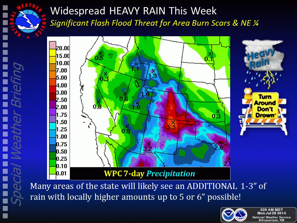
The latest 7-day total precipitation forecast calls for widespread 1-3" for many areas of the state with locally higher amounts up to 7-8" possible through Saturday night, especially over the Sangre de Cristo mountains and northeast quarter.
Gusty easterly gap winds into the central valleys tonight into Monday morning, and again later Wednesday
Overview:
A series of backdoor cold fronts will combine with increasing monsoon moisture and bring a significant increase in thunderstorm activity this week. The main threat from the slow-moving thunderstorms will be heavy rain and flash flooding as well as deadly cloud to ground lightning, but a few storms will likely contain hail and strong outflow winds.
Confidence:
High confidence on a forecast trend of increased thunderstorm activity and transition to a potentially very wet pattern, as well as resultant impacts on area burn scars. Lower confidence on the distribution of the heaviest rainfall and identifying the highest flash flood threat day-to-day away from burn scars.
For More Info:
As always, please visit our website at www.weather.gov/abq or http://mobile.weather.govfor further updates. As always, if you have any questions concerning this event or would like to pass along report feel free to call us at 1-888-386-7637 24x7.