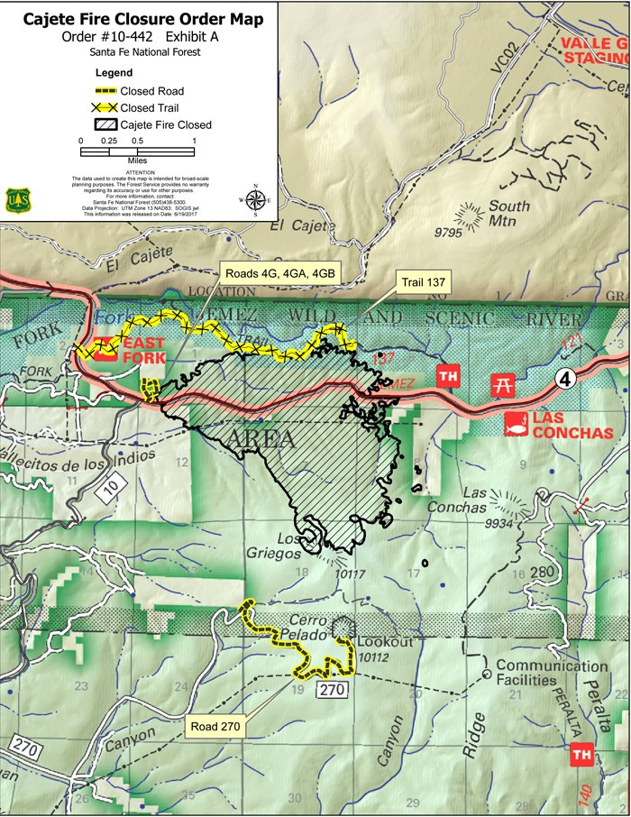
SFNF Issues Closure Order for Cajete Fire Burn Area
SANTA FE, NM – June 20, 2017 – For Immediate Release. The Santa Fe National Forest (SFNF) today issued a closure order for the approximately 1,400 acres on the Jemez Ranger District burned by the Cajete Fire. The restricted area includes:
· all lands, roads and trails within the fire perimeter (depicted on the closure map),
· Trail #137 between the last bridge coming from the Las Conchas Trailhead (before the trail ascends) and the East Fork Trailhead, and