slideshow 1 slideshow 2 slideshow 3

National Weather Service Issued Alerts (Jaroso Post-Fire Response Burned Area Emergency Response)

NATIONAL WEATHER SERVICE ISSUED ALERTS For safety, communities need to monitor local weather reports and public safety bulletins, local road closures, emergency notifications, weather alerts, follow local county and city advisories, and act accordingly. DEFINITIONS FOR NATIONAL WEATHER SERVICE ISSUED ALERTS: http://w1.weather.gov/glossary/ ADVISORY (ADVY): An advisory highlights special weather conditions that are less serious than a warning.

Thompson Ridge BAER Assessment Update - 7/9/2013 (Thompson Ridge Post-Fire Response Burned Area Emergency Response)

Thompson Ridge BAER Assessment Update – July 9, 2013 JEMEZ SPRINGS, NM (July 9, 2013) – For the past few days, the Thompson Ridge burn scar has experienced some monsoon rain events. The Forest Service’s Jemez Springs Ranger Station and the Valles Caldera National Preserve (VCNP) shared these recent observations: On Saturday afternoon, July 6, there was some minor sheet flow flooding along the VC02 road in the lower Redondo Canyon (near the west gate), but no flooding was reported in the upper Redondo watershed (Union building and up-canyon) area.

NRCS FINANCIAL ASSISTANCE AVAILABLE FOR WILDFIRE-IMPACTED FARMER-RANCHERS (Jaroso Post-Fire Response Burned Area Emergency Response)

(NRCS) FINANCIAL ASSISTANCE AVAILABLE FOR WILDFIRE-IMPACTED FARMERS AND RANCHERS ALBUQUERQUE, N.M. – USDA’s Natural Resources Conservation Service is accepting applications for financial assistance from agricultural producers in New Mexico impacted by wildfires of 2011, 2012 and 2013 under the new Burned Lands Initiative. The financial assistance will help address resource concerns on private land through NRCS’ Environmental Quality Incentives Program (EQIP) and Wildlife Habitat Incentive Program (WHIP).

NRCS FINANCIAL ASSISTANCE AVAILABLE FOR WILDFIRE-IMPACTED FARMERS-RANCHERS (Thompson Ridge Post-Fire Response Burned Area Emergency Response)

UDSA NATURAL RESOURCES CONSERVATION SERVICE (NRCS) FINANCIAL ASSISTANCE AVAILABLE FOR WILDFIRE-IMPACTED FARMERS AND RANCHERS ALBUQUERQUE, N.M. – USDA’s Natural Resources Conservation Service is accepting applications for financial assistance from agricultural producers in New Mexico impacted by wildfires of 2011, 2012 and 2013 under the new Burned Lands Initiative. The financial assistance will help address resource concerns on private land through NRCS’ Environmental Quality Incentives Program (EQIP) and Wildlife Habitat Incentive Program (WHIP).

Flood Advisory: Heavy Rains over Jaroso Burn Scar (Jaroso Post-Fire Response Burned Area Emergency Response)

Flood Advisory: Heavy Rains over Jaroso Burn Scar AT 12:31PM: An arroyo and small stream Flood Advisory was issued Monday by the National Weather Service in Albuquerque for the Northeastern Santa Fe County in North Central New Mexico, extreme West Central Mora County and extreme Northwestern San Miguel County in Northeast New Mexico until 2:30PM. AT 12:29PM MDT: National Weather Service doppler radar indicated heavy rain over the Jaroso Burn Scar in extreme West Central Mora County.

Flash Flood Warning: Thompson Ridge & Las Conchas Burn Scars for 7.8.2013 (Thompson Ridge Post-Fire Response Burned Area Emergency Response)

Flash Flood Warning: Heavy Rains Over Thompson Ridge and Las Conchas Burn Scars An Area Flood Advisory was issued Monday by the National Weather Service in Albuquerque for the Northwestern Los Alamos County, South Central Rio Arriba County, and Northeastern Sandoval County in North Central New Mexico until 4:15PM. AT 1:20PM MDT: National Weather Service doppler radar indicated heavy rain Northwest of Los Alamos across the northern portion of the Las Conchas and far northeast portion of the Thompson Ridge burn scars. These storms were slowly drifting east.

Flash Flood Warning: Heavy Rains over Tres Lagunas Burn Scar (Tres Lagunas Post-Fire Response Burned Area Emergency Response)

A Flash Flood Warning was issued Monday by the National Weather Service in Albuquerque for the Northwestern San Miguel County in Northeast New Mexico until 3:30 PM MDT. At 1:36 PM MDT the National Weather Service Doppler Radar indicated very heavy rain from a thunderstorm about 18 miles East of Santa Fe. The storm producing heavy rain was nearly stationary. Up to one inch of rain may fall in less than 30 minutes. This will impact the Tres Lagunas Burn scar including, but no limited to, Holy Ghost Creek and the Summer Home area...

Burn Severity Mapped for Jaroso Fire - July 7, 2013 (Jaroso Post-Fire Response Burned Area Emergency Response)

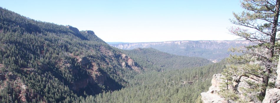
BAER Assessment Update – July 7, 2013 PECOS, NM (July 7, 2013) – The BAER assessment team continues their analysis for the Jaroso wildfire that has burned 11,141 acres of the Pecos Wilderness area on the Santa Fe National Forest (www.fs.usda.gov/santafe/). The BAER team is working and coordinating with the Forest, tribal governments, USDA Natural Resource Conservation Service (NRCS), state agencies, counties, communities, and other local agencies in support of their rapid BAER assessment efforts.

Special Notice (Thompson Ridge Fire Wildfire)

Special Notice: For Thompson Ridge Fire information, please call 505-661-3333 during the hours of 8:00 am – 4:30 pm Monday through Friday or email

Weekend Thunderstorms Flood & Block Forest Road - Equipment Ordered Monday (Tres Lagunas Post-Fire Response Burned Area Emergency Response)

PECOS, NM – The Burned Area Emergency Response (BAER) implementation team inspected Sunday the areas that received heavy rains throughout the weekend. Thunderstorms resulted in minor flooding within the Tres Lagunas Fire burn scar. Sediment and small rocks were carried over one portion of NM63 between the Windy Bridge and Tererro areas within the Santa Fe National Forest. The area most affected though was Forest Raod 122, better known as Holy Ghost, which is currently impassible (and remains closed anyway) after rocks rolled over it.

Pages