slideshow 1 slideshow 2 slideshow 3

Jaroso BAER Assessment Update - July 5, 2013 (Jaroso Post-Fire Response Burned Area Emergency Response)

BAER Assessment Update – July 5, 2013 PECOS, NM (July 5, 2013) – On July 3, a Forest Service BAER assessment team assembled to begin their analysis for the recent Jaroso wildfire that burned approximately 11,000 acres of the Pecos Wilderness area on the Santa Fe National Forest (www.fs.usda.gov/santafe/).

PREPARING FOR RAIN STORMS (Jaroso Post-Fire Response Burned Area Emergency Response)

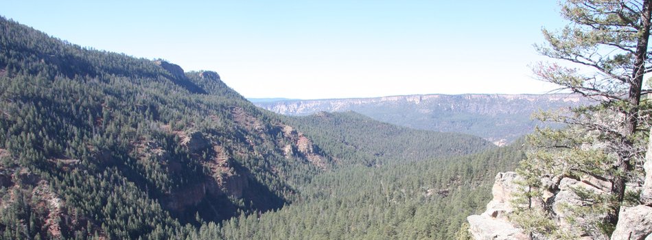
PREPARING FOR RAIN STORMS PECOS, NM (July 5, 2013) – The Jaroso Fire is currently burning in the rugged, steep, deep canyons of the Pecos Wilderness on the Santa Fe National Forest. It is burning in mixed-conifer, heavy dead and down, woody material with pockets of bug-killed trees, and in a 1,300-acre area of 2007 blown-down timber. The wildfire has increased the potential for flash flooding, mud and debris flows that could impact several communities, homes, roads, and other infrastructures adjacent to and downstream from the burned area.

THREE PHASES OF WILDFIRE REHABILITATION (Jaroso Post-Fire Response Burned Area Emergency Response)

THREE PHASES OF WILDFIRE REHABILITATION There are three phases of rehabilitation following wildfires on federal lands: o Fire Suppression Repair o Emergency Stabilization-Burned Area Emergency Response (BAER) o Long-Term Recovery and Restoration Fire Suppression Repair is a series of immediate post-fire actions taken to repair damages and minimize potential soil erosion and impacts resulting from fire suppression activities and usually begins before the fire is contained, and before the demobilization of an Incident Management Team.

Jaroso Fire Update July 4, 2013 (Jaroso Fire Wildfire)

WILDLAND FIRE MANAGEMENT TEAM Fire Information: 505-438-5446 For Immediate Release: July 4, 2013, 8 a.m. Fire Facts Date Reported: 06/10/2013 Number of Personnel: 53 Location: Espanola and Pecos-Las Vegas Ranger Districts within the Pecos Wilderness Equipment: 3 engines Crews: -0- Cause: Lightning Aircraft: 3 helicopters Size: 11,141 acres based on Infrared flight Injuries to Date: None Evacuations: none Percent Contained: 0% General Information/Announcements: The Northern Rockies Wildland Fire Management Team will be leaving on Friday July 5.

Forest Service and Pecos Community Work Together on Post-Fire Efforts (Tres Lagunas Post-Fire Response Burned Area Emergency Response)

PECOS, NM – Rehabilitation of the Tres Lagunas burn area continues Saturday within the Pecos/Las Vegas Ranger District of the Santa Fe National Forest. The Burned Area Emergency Response (BAER) implementation team has installed warning signs along Forest Service roads advising the public of potential dangers that include flooding, rolling rocks, and falling trees. Soon, the team will remove hazardous trees and debris from streams to protect the public.

Jaroso Fire Update July 3, 2013 (Jaroso Fire Wildfire)

WILDLAND FIRE MANAGEMENT TEAM Fire Information: 505-438-5446 For Immediate Release July 3, 2013, 11 a.m.

Thompson Ridge BAER Assessment Update - July 3, 2013 (Thompson Ridge Post-Fire Response Burned Area Emergency Response)

BAER Assessment Update – July 3, 2013 JEMEZ SPRINGS, NM (July 3, 2013) – On Saturday, June 29, the Burned Area Emergency Response (BAER) assessment team provided its findings to managers from the Valles Caldera National Preserve (VCNP) and the Santa Fe National Forest (Forest). Of the approximate total of 23,000 acres burned by the Thompson Ridge Fire and analyzed by the BAER team, 22,927 acres were Valles Caldera National Preserve, 39 acres were national forest land, and 34 acres were private land.

BAER Definitions Used in Values-at-Risk Matrix (Thompson Ridge Post-Fire Response Burned Area Emergency Response)

BAER Definitions used in Values-at-Risk Matrix The following information are Burned Area Emergency Response (BAER) definitions used by the BAER team for the values-at-risk (VAR) Matrix (see separate article and posted PDF document for the VAR Risk Level Matrix) when assessing the risk level for each identified value-at-risk having the potential for increased run-off and soil erosion following a wildfire.

BAER Risk Level Matrix for Identified Values-at-Risk (Thompson Ridge Post-Fire Response Burned Area Emergency Response)

BAER Risk Level Matrix for Identified Values-at-Risk Attached to the right is a PDF document that displays the BAER matrix used to evaluate the risk level for each of the values-at-risk identified during the BAER assessment for potential increased run-off and soil erosion downstream of burned areas following major rain

BAER DESCRIPTION OF BURN SEVERITY RANKINGS (Thompson Ridge Post-Fire Response Burned Area Emergency Response)

BAER DESCRIPTION OF BURN SEVERITY RANKINGS The appearance and characteristics of the three burn severity levels that are used by Burned Area Emergency Response (BAER) scientists and specialist can vary from ecosystem to ecosystem, so it is difficult to give hard-and-fast definitions. There are different kinds of criteria that is reviewed by the BAER team both by air reconnaissance and by on the ground field surveys. Attached to the right, is a PDF document that describes the BAER burn severity

Pages